
Map Bristol Township ZIP Code Coverage
Bucks County’s 202403 Site Address Points layer can be queried for the municipal-service value BRISTOL TOWNSHIP. Its distinct postal-code results produce the eight ZIP codes below. They describe postal codes returned for Township site-address points. They do not state that each whole ZIP lies in Bristol Township, define a USPS legal delivery boundary, or supply a list of people at those addresses. Confirm a particular delivery address through USPS after comparing the parcel and municipal fields.
| ZIP | Areas Covered | Post Office | Notes |
|---|---|---|---|
| 19007 | Bristol Township site-address points | Postal community: Bristol | Township offices use Bristol, PA 19007; the ZIP also reaches adjacent Bristol Borough. |
| 19021 | Township vicinity and postal slice | Postal community: Croydon | Confirm a specific address with USPS. |
| 19030 | Township edge and locality slice | Postal community: Fairless Hills | It does not mean that all Fairless Hills addresses are in the Township. |
| 19047 | Small slice near Zimmerman Lane and New Falls Road | Postal community: Langhorne | Do not represent it as a broad Township neighborhood. |
| 19054 | Township address-point slice | Postal community: Levittown | Verify at the property level. |
| 19055 | Broad Levittown postal use | Postal community: Levittown | Includes the Levittown Regional Library area. |
| 19056 | Township site-address points | Postal community: Levittown | A Township polling place uses Newportville, PA 19056, a postal-label mismatch rather than a conflict. |
| 19057 | Township site-address points | Postal community: Levittown | Township polling material uses this ZIP for Levittown facilities. |
The result is a compact picture of Bristol Township’s postal geography. It is intentionally more cautious than a full-ZIP map claim. The county field identifies site-address data; postal service, municipal authority, parcel identity, and a current property record remain separate sources.
Note: Each ZIP in the table is an address-point result for Bristol Township, not proof that every address or all territory in that postal code belongs to the Township.
Separate Bristol Township Postal Labels
Bristol Township is a legal municipality in Bucks County. Bristol, Croydon, Fairless Hills, Langhorne, Levittown, and Newportville are postal or local labels that can overlap or slice through municipal geography. The 19007 entry shows the sharpest local example: Bristol is a postal community, but the ZIP also serves nearby Bristol Borough. A postal city field therefore does not identify the municipality that holds a parcel or a municipal file.
The eight-code result is a useful local geographic finding. Several entries carry Levittown as their postal community, and the Township’s postwar Levittown history spans Bristol, Falls, Middletown, and Tullytown. A historical or postal reference to Levittown needs an address, parcel, ward, or custodian check before it is treated as Bristol Township evidence.
The county’s PASDA Site Address Points layer is the detailed local address authority. It records a physical address, postal code, postal community, municipal-service community, incorporated municipality, unincorporated community, neighborhood or community, and parcel ID. Those separate fields explain a mismatch without turning it into an error.
Verify Bristol Township ZIP Codes
Use USPS ZIP Code Lookup by Address as the final delivery check for a particular mailing address. The form requires a street address and accepts optional company or unit details, city, state, and ZIP. USPS also provides city-and-state and ZIP-to-city modes. Its result verifies postal delivery information. USPS specifically cautions that a lookup does not confirm a person or organization at an address.
The USPS ZIP Code Lookup page shown here is the official postal confirmation route for a Bristol Township ZIP code directory search.
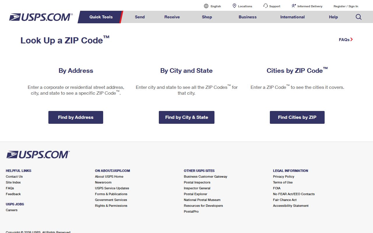
Start by checking the county parcel or municipal data, then submit the full delivery address to USPS. When the postal response differs from a local label, preserve both results and use the parcel, municipal-service, and incorporated-municipality fields to identify which office has the relevant record.
Search a Bristol Township ZIP Code
A ZIP can narrow a record search, but it cannot replace the primary keys used by county systems. The Tax Claim form says parcel number or last name and address are the main query routes. Its ZIP field sits in Owner Information, so it is best treated as an additional mailing filter. The property form does not state that a ZIP-only query will return every parcel in a postal code, and neither the public parcel viewer nor the state voter-status tool has a verified ZIP directory mode.
- Check the full mailing address in USPS ZIP Code Lookup and preserve the delivery ZIP that USPS returns.
- Query the Bucks Tax Claim form with the house number and street name, or a parcel number or last name where available, then select Bristol Township.
- Use the ZIP Code field only as a supporting owner or mailing filter. Compare it with the physical location rather than treating it as a municipal boundary.
- Review the PASDA address-point fields and Bucks Maps & Data for municipal and parcel geography. No verified public ZIP filter was captured for the parcel viewer.
- When a ZIP has narrowed the area to one street, continue with the Bristol Township street directory record chain for parcel and title work.
PA Check My Registration Status is an individual status route, not a ZIP search. The separate voter-list request process has a signed-affirmation and restricted-use gate, so it should not be treated as a public ZIP roster.
Note: Postal delivery confirmation is one step in a search. Parcel, title, and municipal records still need their own correct entry keys.
Use Bristol Township ZIP Search Fields
The Bucks County Tax Claim Property Information form supplies the observed ZIP-capable search field set. It has no published historical coverage start, result-pagination rule, or export description on the public screen. Its value here is practical: it makes clear that postal filtering belongs beside parcel, location, municipality, and owner information, rather than replacing them.
| Field | Type | Required | ZIP research use |
|---|---|---|---|
| Parcel Number | Text | Either this or last name/address | Primary parcel identifier; retain all dashes. |
| Location Address | Text | Either parcel or last name/address | Enter house number and street name only. |
| School District | Dropdown | No | An optional administrative-geography filter. |
| Municipality | Dropdown | No | Select Bristol Township to avoid countywide name overlap. |
| Name | Text | No | Use last name first where an owner clue is known. |
| Mailing Address | Text | No | Separate correspondence filter. |
| City | Text | No | Owner-information postal city filter. |
| ZIP Code | Text | No | Supporting owner or mailing filter, not a full-ZIP property listing claim. |
Assessment’s live consumer portal was under maintenance during the research, so no separate verified ZIP filter was captured there. The PASDA service can query Post_Code, but it is technical address data, not a list of residents. Use the accessible Tax Claim form for the public property route and verify each result at the parcel level.
Read Bristol Township Address Terms
Postal and municipal searches become more reliable when the field names are kept distinct. The county’s address layer records several related labels, each designed for a different part of the address system.
- ZIP code
- A postal delivery code. It can cross a municipal line and is not a parcel, title, or municipal-boundary identifier.
- ZIP+4
- An added postal extension paired with a ZIP code. The county address layer stores it separately as
Post_Code4. - Postal community
- The postal locality label stored as
Post_Comm, such as Bristol, Croydon, Langhorne, or Levittown. - MSAG community
- The municipal-service address community stored as
MSAGComm. The County address query uses BRISTOL TOWNSHIP. - Situs address
- The physical location of a parcel, distinct from an owner’s mailing address and from a deed’s legal description.
These definitions also explain why a search can return a valid postal city while the parcel belongs to a different incorporated municipality. The field disagreement is often a routing fact, not a contradiction.
Compare Bristol Township ZIP Boundaries
ZIP-code geography and Bristol Township limits overlap without matching. The 19030 Fairless Hills result is an edge or locality slice, while 19047 is a small Langhorne slice near Zimmerman Lane and New Falls Road. Both facts are narrower than a claim that the entire postal community belongs to the Township. Likewise, 19054 is only an address-point slice and needs property-level confirmation.
The Bristol and Levittown labels carry different local pitfalls. The 19007 Bristol code reaches the adjacent Borough. The Levittown codes 19055, 19056, and 19057 show broader postal patterns, but their labels do not draw municipal lines. A particular address must be checked in the county layer, property form, and USPS result before the ZIP is used to select a local records office.
Track Bristol Township Levittown Labels
Several entries in the Bristol Township ZIP code directory return Levittown as the postal community. The distinction matters because the postwar Levittown area extends across Bristol, Falls, Middletown, and Tullytown. A record labeled Levittown can therefore lead to a different municipality or a different collection than the Township. The correct next question is which parcel and municipal-service fields accompany the address, not whether the postal label sounds familiar.
The 19056 entry offers a concrete local mismatch: the county address layer returns Levittown as the postal community, while a Township polling place uses Newportville, PA 19056. Both labels can be valid in their own systems. Neither one, on its own, settles a municipal boundary or a property’s title location.
Township notification categories also include Croydon, Newportville, Edgely, and several Levittown-area clusters. They are service-notification geographies, not property boundaries or address lists. They are useful reminders to test local place terms separately in an archive or records index.
Set Limits on a ZIP Code Directory
A Bristol Township ZIP code directory can show which postal codes appear in county address-point data, verify a mailing address, and help narrow a parcel search. It cannot establish a municipal boundary for an entire ZIP or identify everyone connected to a delivery address. USPS checks delivery information, not a person or organization. The Tax Claim form organizes property and owner-search fields, but its ZIP field is not documented as a full postal-area listing.
Title research relies on a parcel, legal description, party name, and approximate time. The Recorder’s index is party based rather than ZIP based. State voter status is not a ZIP directory, and regulated voter-list materials carry their own request and use rules. Keep a ZIP as one postal clue among several, then return to the record whose key matches the question.
Note: When a ZIP, postal city, and municipal label differ, preserve all three and use the parcel record to determine the proper local route.