
Bristol Township Neighbors by Block
A Bristol Township block search needs to separate land geometry, title names, and household facts. The public map can show the parcels around a target. The county property form supplies a current parcel and possible owner or mailing clue. The Recorder can test a title party and legal description. Notice categories and historic directories add context, but neither turns into a list of everyone around an address. Start with the official source that matches the question, then preserve the record date and its stated limit.
| Source | What It Shows About a Block | Access |
|---|---|---|
| County Parcel & Floodplain Viewer | Adjacent parcel geometry and flood-map context | Public GIS viewer; owner names are suppressed |
| Bucks Tax Claim Property Information | Parcel, location, and owner or mailing search fields | Public current property form |
| Bucks Recorder and LANDEX | Title parties, legal descriptions, and historic ownership trail | Research area, fee-based LANDEX, or copy request |
| Township Planning and Zoning | Public project, case, and address context | Current land developments, Zoning Hearing Board agendas, or targeted RTKL request |
| Township Notify Me | Voluntary notice-category geography names | Public subscription page; not a member directory |
Owners and occupants are not interchangeable. A property result can start a current title inquiry, while a deed records a transfer between parties. Neither source confirms every person present at a location. A neighboring polygon can also be a common area, association tract, commercial tract, or right-of-way, so it should not be presumed to represent a household.
Bristol Township Neighbors and Parcel Geometry
The Bucks County Maps & Data portal is the county's public GIS entry for parcels, municipal boundaries, zoning, proposed developments, polling places, and voting districts. The specific Parcel & Floodplain Viewer is JavaScript-driven, and the research did not verify a stable search, buffer, radius, or export control. It is therefore not sound to promise a nearby-person output or a radius ownership file from the map.
Use the viewer conservatively. Browse to the target street, identify the target polygon and its visible parcel reference or address label, then inspect the immediately touching polygons one by one. The viewer's public design suppresses owner names. Move every captured parcel reference to the Tax Claim property form or the Recorder rather than treating a map popup as ownership proof. Parcel shape establishes adjacency, but it does not establish a relationship between the people connected to separate parcels.
Note: If a boundary is unclear, a Recorder legal description may still require a surveyor to locate the line accurately.
Bristol Township Neighbor Parcel Checks
Work outward from one address in a short, documented sequence. The parcel form asks for either a parcel number or a last name or address. For address searching, it instructs users to enter a house number and street name only. Municipality can narrow a same-street search to Bristol Township. Its mailing-address, city, and ZIP fields are separate filters, so they should be read as correspondence information rather than a statement about who is currently at the parcel.
- Locate the target in the public Parcel & Floodplain Viewer and note its polygon, visible parcel reference, and address label where available.
- Visually identify only the parcels that touch the target or share the relevant frontage, then record each separately.
- Run each reference through the Bucks County property form, using the Bristol Township municipality filter where useful.
- For a title question, use the parcel clue and current party name in the Recorder's research route or LANDEX.
- Check current development or zoning material only when an address-linked project question remains.
Target address → parcel geometry → each adjacent parcel → property form → Recorder title check.
For the longer address chain along a named road, the Bristol Township street directory uses the same records in a by-street sequence.
Bristol Township Neighbor Owner Checks
The Bucks County Recorder of Deeds Property Records page reports holdings from 1684 to present, but historic documents are indexed by party and year, not by today’s street address. In Recorder language, the direct party is the seller or grantor, and the indirect party is the buyer or grantee. Start with the property form's parcel and owner clue, then search a current party with an approximate transaction period. The deed's legal description and recital, sometimes called a being clause, point to an earlier transfer.
LANDEX reports Bucks data and index coverage from 1980 to present, while reporting images from 1684 to present. It is a fee-based channel. The Recorder also documents a public research area, brief LANDEX tutorial help, telephone or mail copy requests, and an owner's free deed copy by email. Staff-request copies are $1 per page, self-service public-computer copies are $0.50 per page, certification adds $1.50, and mail requests require a self-addressed stamped envelope. Treat title parties as title evidence, not proof that someone is presently at the address.
For address-linked projects, the Township's Current Land Developments page and Zoning Hearing Board agenda archive can show public case information. No public historic permit or code-file search was verified. For a known file, send a focused address, date-range, and document-type request through the Township's Right-to-Know channel instead of assuming an application portal makes old material searchable.
Bristol Township Neighbor Notice Geographies
No official Township HOA, block-captain, or association roster was located. The Township's Notify Me service does publish voluntary notice categories that help identify names used for portions of Bristol Township. Those labels are useful geographic context when reading a parcel record, planning item, or historical source. They are not property boundaries, associations, address lists, or evidence that a person belongs to a group.
Croydon Notice Geography
Voluntary Township notice categories include Croydon and Croydon Acres, Croydon Manor, and Maple Shade. They are subscription categories, not a roster.
Edgely Notice Geography
Edgely, Radcliff Street, Paper Mill Village, and Landreth Manor appear as a voluntary notice category, not a legal boundary or association list.
Levittown-Area Notice Geography
Goldenridge, Green Lynne, Orangewood, Whitewood, and Yellowwood are grouped for voluntary notices. Confirm an address before using any local label.
See the Township's Notify Me subscriptions for the official category names shown in the source image.
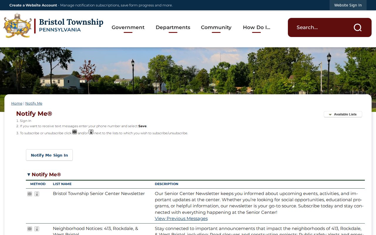
These names can help distinguish a local notice geography from a postal or historic place label. They do not identify members, residents, or property ownership.
Bristol Township Neighbor Tools Compared
Official records and commercial neighbor tools serve different purposes. A county form or Recorder document identifies its custodian and record type, while commercial listings can combine public and other data without proving a parcel relationship or a current presence. For a Bristol Township block question, return to the official parcel and title trail when a result conflicts, omits a date, or uses a different location label.
| Official record route | Commercial neighbor-tool category |
|---|---|
| County property form, Recorder records, GIS geometry, and public planning material identify the custodian and access route. | May combine sources, but can be stale, incomplete, or wrong and does not replace the custodian record. |
| Shows the stated parcel, title, or case context and its documented limits. | Does not establish every household member, current presence, or protected information. |
| Allows a record-by-record comparison of date, parcel, and legal description. | Should never override an official restriction or be treated as a verified neighborhood roster. |
For local history rather than current block facts, Grundy's Bristol History collection is an archive route. It holds material for Bristol Borough and surrounding areas, so a particular directory or newspaper item must still be checked against the Township parcel and time period.
Bristol Township Neighbor Voter Lists
Pennsylvania's Check My Registration Status route is an individual status-confirmation tool, with a county office and 1-877-VOTESPA as documented alternatives. It is not a browse-by-street neighbors list. The form was not safely transcribed during research, so no current field labels or result details should be assumed from it.
The address-oriented state material is the formal voter-list request form. It defines Public Information, Street, Walking, and Full Voter Export products and says delivery is electronic. The form states a $20 charge for a Full Voter Export for one county or all counties and $20 per county for other list types. It also requires identification and a signed affirmation limiting use to election, political activity, or law enforcement, with no internet posting. Verify the current form before any request.
Street and Walking list fields are regulated, not material for public reposting. Registration status is not proof of a move date, and Pennsylvania's Address Confidentiality Program can provide a substitute address for qualifying participants. Do not try to infer a protected address from a missing or substitute record.
Note: Bucks County has 304 voting districts, and a Bristol Township street can cross ward or precinct lines, so current address verification matters.
Bristol Township Neighbor Privacy Limits
Public parcel and deed records do not create a complete view of a block. The GIS viewer suppresses owner names. The tax form distinguishes location from mailing information. Recorder material records title parties, not everyone present at a property. Utility and delivery details are not established public block sources, and PennDOT says a plate alone does not disclose ownership. Pennsylvania Right-to-Know Law Section 706 requires agencies to redact protected information where the rest of a record can be released.
Pennsylvania's Address Confidentiality Program is a safety-plan service for qualifying participants and can place a substitute address on voter registration and other specified government records. Judicial files may also be sealed, expunged, juvenile, or otherwise limited. A missing record can reflect lawful protection or a custody rule, not an invitation to seek around it.