
Trace a Bristol Township Street Directory
A street search in Bristol Township works best as a chain of records, not as a list of everyone connected with an address. The county Tax Claim screen can connect a house number and street to a location, parcel, municipality, and owner or mailing clue. That starting result can then support a title search. A deed trail records land parties and legal descriptions, while a current election record has its own access rules. Historical volumes can add a dated address clue only when their geographic scope fits the address.
Keep a short research log as the record trail changes hands. Write down the street spelling, parcel number, municipality, owner name, legal description, deed reference, and date used in each search. Bristol Township shares postal and historical naming patterns with nearby places, so a match should be tied back to the parcel or record custodian before it is treated as local.
- Enter the house number and street name in the Bucks County Tax Claim Property Information form. Select Bristol Township where needed, then retain the parcel number and location details.
- Use the parcel, current owner, and any tax-map reference to distinguish the physical parcel from an owner mailing address. The mailing field is correspondence data, not evidence of current presence.
- Search the owner as an indirect party in Bucks County Recorder of Deeds Property Records and LANDEX, then read the deed’s legal description and prior-conveyance recital.
- For a use permitted under current state rules, use the formal Street List or Walking List request route. It requires identification and a signed affirmation, and the material cannot be posted online.
- Check a dated Grundy Bristol Borough directory only as a historical clue. Confirm that the volume and street actually cover the relevant place before relying on it.
Note: This sequence identifies parcel and title evidence first, then uses regulated or historical material only for the narrower question each source can support.
Run a Bristol Township Property Search
The county’s property form is the clearest observed address entry point for a Bristol Township street directory. It accepts either a parcel number or a last name and address. Start with only the house number and street name in Location Address, then select Bristol Township to avoid same-street results elsewhere in Bucks County. If a parcel identifier is already known, preserve all of its punctuation. The form’s separate Property Information and Owner Information areas are a useful warning that parcel location and mail delivery are different facts.
The Bucks County Tax Claim Property Information search is pictured below, including the location, municipality, owner, mailing-city, and ZIP inputs used to narrow a record.
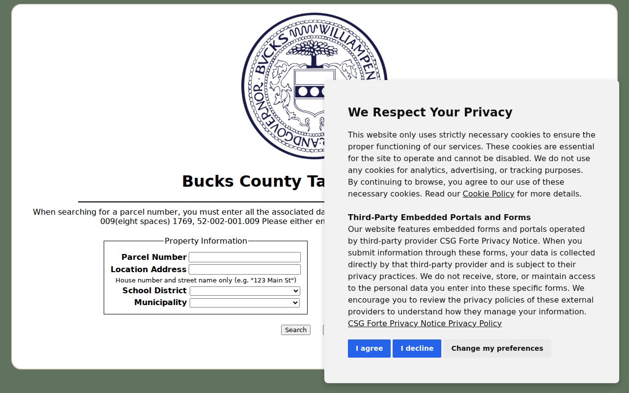
The form can launch an address investigation, but the research did not verify a historical coverage start, result export, or every field on a returned parcel card. Treat the observed input groups as a search method, not a promise of a complete record inventory.
| Field | Type | Required | Bristol Township use |
|---|---|---|---|
| Parcel Number | Text | Alternative to last name/address | Retain every dash and punctuation mark. |
| Location Address | Text | Alternative to parcel/name | Enter the house number and street name only. |
| School District | Dropdown | No | Use only when the administrative area is known. |
| Municipality | Dropdown | No | Select Bristol Township to narrow the countywide search. |
| Name | Text | No | Enter a last name first when an owner clue is known. |
| Mailing Address, City, ZIP Code | Text | No | These are owner correspondence filters, not substitutes for situs. |
Map Bristol Township Parcels Carefully
Bucks Maps & Data is the county map entry point. County GIS supports the assessment parcel database and maintains data for parcels, municipal boundaries, zoning, proposed developments, polling places, and voting districts. Those layers can place an address in its geographic setting. They do not turn the map into a roster. The research did not verify the current labels for every live viewer control, so a careful method is to browse to the street, identify the parcel reference where displayed, and repeat the property-form search for each parcel.
The Bucks County Board of Assessment page capture shows the assessment-side route used when an address needs a parcel or tax-map reference.
Public parcel mapping is especially useful for geometry, not for assuming that a map popup supplies ownership. The publicly used Parcel & Floodplain Viewer suppresses owner names. Return to the assessment and Recorder routes to verify a named title party.
For address normalization, the county’s PASDA Site Address Points layer distinguishes a full physical address, postal code, postal community, municipal-service community, incorporated municipality, neighborhood label, and parcel ID. That extra detail helps explain why two records can use different locality labels for the same general area.
Note: A parcel shape can identify land on a map, while the property record and deed route are needed to verify the related title evidence.
Follow a Bristol Township Title Chain
Street names are not the Recorder’s fundamental historic index. Bucks records are organized around direct parties, such as a seller or borrower, and indirect parties, such as a buyer or lender, with an approximate year. Once the property form supplies a current owner and parcel clue, search that owner as the likely indirect party. The resulting deed should be read for its legal description and the recital often called the being clause. That recital names a prior conveyance and gives a book, page, or instrument reference for the next step backward.
The LANDEX document-search route is the paid online channel used with Bucks Recorder records.

Recorder custody reaches from 1684 to the present. LANDEX reports Bucks data and index coverage from 1980 forward, plus images from 1684 forward, while historic index-book work and the research area remain important access paths. New Bucks recordings use instrument numbers rather than new book and page citations after July 1, 2012. The date changes how a citation is read, not who keeps the record.
LANDEX is not the only route. The Recorder’s public research area at 55 E. Court Street in Doylestown provides terminals and historic indexes. The office also accepts telephone or mail copy requests, with a self-addressed stamped envelope for mail, and offers an owner a free deed copy by email. Staff-request copies are listed at $1 per page, public-computer copies at $0.50 per page, and certification adds $1.50.
Compare Bristol Township Address Records
Each address-keyed source contributes a different part of the Bristol Township street directory. The useful result is a documented record trail, not an assertion that every person connected with a street has been found. Pair the records by their real keys: a parcel can lead to a location and tax-map reference, a legal description can bridge to title papers, and an address can identify a planning file. A voter list has a separate legal gate.
| Address-keyed record | Entry key | Custodian and access | What it can establish |
|---|---|---|---|
| Tax and property information | Parcel, location, name, municipality | Bucks County Tax Claim public form | Parcel, situs, and owner or mailing-search organization. |
| Parcel and planning geography | Map location and parcel reference | Bucks Maps & Data public map resources | Parcel geometry and map context, not a named household list. |
| Deeds, mortgages, and plans | Party, year, book/page, instrument | Recorder research area, LANDEX, or copy request | Title parties, legal description, and prior-conveyance references. |
| Planning and zoning material | Project, case, property, or address | Township public files or focused RTKL route | Project and physical-change context where releasable. |
| Regulated election materials | Formal request and permitted list type | State voter-list request process | Specified registration fields, subject to strict use conditions. |
| Historic directories | Name, address, volume year, page | Grundy digital and local-history collection | A dated historical clue where geographic coverage fits. |
A chain that ends at a deed proves a title relationship, not current presence. A planning entry can date a project without listing all people linked to a property. Keep those limits visible when comparing records from the same street.
Note: Use the strongest matching key in each system rather than forcing a street address into an index designed for parties or parcel numbers.
Check Bristol Township Planning Files
Address-linked planning material can explain work or land activity that a property and deed record cannot. The Township Planning Department handles building, zoning, property-maintenance, and land-development records. Its Current Land Developments page publishes project or case numbers, property or address details, categories, and linked files. The Zoning Hearing Board archive provides another public route for case and meeting material.
No searchable public archive of completed historic permits, inspections, code files, or plans was verified. For a targeted record, use the Township Right-to-Know request route and state the project, address, department, file type, and date span. The Township lists Randee J. Mazur as Open Records Officer at rtk@bristoltownship.org and 267-812-2888. Judicial and Recorder materials follow their own custody rules, so the Pennsylvania RTKL does not replace their procedures.
Handle Bristol Township Voter Lists Lawfully
PA Check My Registration Status is an individual-facing status route, not a street browse tool. The observed research did not establish its live fields as a public street search, and it should not be represented as one. Bucks County’s mapping resources can show voting-district and polling-place geography, but geography does not identify individual voters.
Address-oriented election data comes through the state’s voter-list request form. The form describes Public Information, Street, Walking, and Full Voter Export options. Street and Walking Lists include different address fields, and the broader files include sensitive data. Electronic requests require identification and a signed affirmation. The form limits use to stated election, political, or law-enforcement purposes and bars online posting. It lists $20 for a Full Voter Export for one county or statewide, and $20 per county for other lists. Verify current instructions before ordering.
Use Bristol Township Historic Address Clues
The nearby Grundy collection gives a useful, but limited, historical layer to a Bristol Township street directory. Its digitized Bristol Borough directories are intermittent volumes from 1871, 1884, 1891, 1894, 1898, 1905, 1910–11, 1914, 1929, 1941, 1951–52, and 1953–54. The material is page-level and can help compare a name and address over time. It is not demonstrated as complete Bristol Township or Levittown coverage, and a volume’s page should be checked before treating it as an address match.
Township history also places older records in a changing local landscape of King’s Highway, the Delaware Canal, Silver Lake and Bristol Mills, followed by Fairless Works and the 1950s Levittown transformation. Levittown crosses several municipalities. A historic place label therefore needs a parcel, ward, address, or custodian check before it is folded into a Bristol Township result. For close reading of the older volumes, use the Bristol Township city directory collections.
Note: A dated directory page can support a historical address clue, but its Borough focus and intermittent years prevent it from serving as a universal Township street roll.
Define Bristol Township Street Keys
One address can appear under several labels in county, postal, and title records. Defining the key before searching prevents a mailing field, legal description, and physical location from being treated as the same evidence.
- Parcel
- A county-assessment unit of land. The parcel number is a useful bridge from the property form to tax-map and title research.
- Situs address
- The parcel’s physical location address. It differs from an owner’s mailing address, which is used for correspondence.
- Legal description
- The land description in a deed or related title record. It can remain useful when a street label or number is unclear.
- Criss-cross directory
- An address-first directory arrangement. No complete Bristol Township criss-cross volume was verified, so any historical directory must be checked for its actual scope and arrangement.
The county address-points data also separates postal community, municipal-service community, incorporated municipality, and neighborhood labels. Use those fields to reconcile a search rather than assuming that a postal city name defines the Township boundary.
Respect Bristol Township Street Directory Limits
A Bristol Township street directory can document parcels, title parties, project files, and carefully limited historical or election evidence. It cannot show every person connected to an address. Tax records, deeds, GIS parcels, and permits do not supply a full household account. The public parcel viewer suppresses owner names, and a title record can identify a transfer without proving who was present on a given date.
Driver and address data are not a routine local research source under PennDOT and DPPA rules. Utility customer information and delivery details were not established as public sources. Pennsylvania’s Address Confidentiality Program can also place a substitute address on eligible government records, including voter registration. A protected or absent detail is not a gap to work around.